-40%
Historic Map Reprints Kingdom of Prussia 1845 and Prussian Provinces 18" x 24"
$ 10.53
- Description
- Size Guide
Description
Historic Map ReprintsThe 19th Century Prussia Map Group
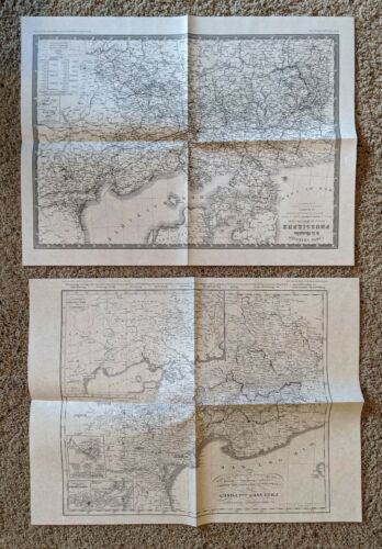
(2) 18" x 24" maps
*The Kingdom of Prussia 1845 - shows the Kingdom of Prussia,, extending from Russia to the Belgian border, with its 37 administrative divisions. Includes an inset map of the principality of Hohenzollern
*The Prussian Provinces: and Posen East Prussia - originally issued in 1833 and revised in 1845, this map portrays East and West Prussia as well as the province of Posen. Hundreds of localities are shown. There are also three insets: one outlines the areas under Prussian control, while the other two show the Danzig and Königsberg areas.
Jonathan Sheppard Books
Fine quality maps from their collection of 18th and 19th century reprints for research and display.
Please see pictures as they are part of the description.
